Your single point of reference for all your Geotechnical Inquiries
GROUND PENETRATING RADAR (GPR) SOFTWARE GPS SOFTWARE
Software by
US Radar INC.
- Enabled GPS compatibility using customer’s receiver
- Works with most GPS units with external data output from handheld to GIS units to RTK rovers
- Receive NMEA strings through USB or serial port
- GNSS capable of processing positions utilizing GPS, Glonass, and Galileo constellations
- Coordinates are displayed in data
- Tap screen at target and coordinates for target are displayed
- Recorded data will display coordinates on screen
- Points can be exported as spreadsheet and/or can be imported into CAD and GIS applications
- GPS Scan triggering capability
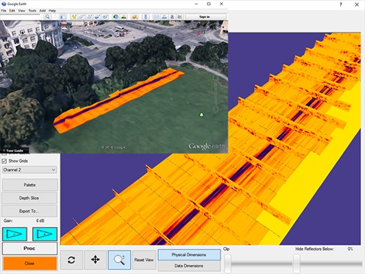
- Optional Google Earth Integration
Country:
USA
USA
User Rating:
You must be registered to vote.


