Your single point of reference for all your Geotechnical Inquiries
3D Imaging & Software
Software by
US Radar INC.
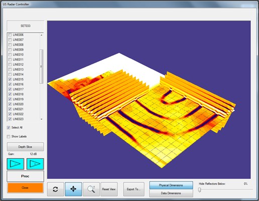
Viewing your GPR scans in 3D allows you to see them more clearly. With our 3D software, you get the power to:
Generate multi-scan slice overlays
Rotate and zoom data slices for analysis
Generate Depth Slices and Peak Maps
Drop paths onto map with GPS integration (optional)
Versatile migration and real-time processing
Time/Depth Slices of user-definable areas/shapes
Adjustable transparency
Adjustable clip plane options
Turn individual scans and slices on and off
Preview generated images before adding them to 3D model
Data can be exported to other viewing software such as Voxler to generate Isosurface Renderings
Data can also be exported in laser scanner/point cloud format
Country:
USA
USA
User Rating:
You must be registered to vote.


