Your single point of reference for all your Geotechnical Inquiries
FPM360 TrueVector
Unifying all data into one easy-to-understand interface
Imagine a solution capable of resolving in real time any qualitative and quantitative information regarding the stability of a pit at any temporal and spatial scale. Imagine a platform so flexible to adapt to any alerting configuration. Then, imagine a unified system that can be accessed anytime anywhere that allows decision makers to maximize the safety of operations.
Full Pit Monitoring 360 (FPM360) is the ecosystem that brings stability and safety awareness to an unprecedented level, merging together all the data coming from any IBIS slope monitoring unit, such as:
Radar
High resolution camera
Mobile instrument
Semi-permanent device
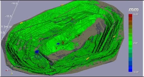
FPM360 unifies any data, providing monitoring experts with a complete view of the entire pit for managing slope hazards. Radar data from multiple IBIS units are not just displayed in the same window, but completely merged into a single universal 3D view of the pit for complete situation awareness.
The FPM streamlines data from multiple monitoring devices into one unique software platform, reducing work processes and saving valuable time needed for making decisions. Controlling a whole pit, or even multiple pits, from a single 3D georeferenced solution, enables the users to tackle data analysis, interpretation and alarming set up with ease.
Italy


