Your single point of reference for all your Geotechnical Inquiries
Map3D
Software by
Mine Modelling Pty Ltd
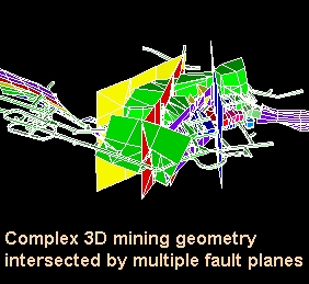
Map3D is a fully integrated three-dimensional layout (CAD), visualization (GIS) andstability analysis package (BEM stress analysis). Various program modules can be used to construct models, analyze and display stresses, strains, displacements, strength factors and probability of failure contours. Map3D is suitable for building and modelling rock and soil engineering design problems involving both irregular 3D massive excavations, tunnels and tabular shapes.
Country:
Australia
Australia
User Rating:
You must be registered to vote.


