Your single point of reference for all your Geotechnical Inquiries
Maptek Eureka
Software by
Maptek
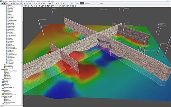
Maptek Eureka provides one integrated platform for viewing and analysing your exploration project data.
Eureka allows you to take spatially located data and put it into context to better understand the inter-connecting relationships between the disparate information. Viewing the data at different scales allows you to see the big picture as well as analyse local areas of interest.
Eureka displays aerial photography, terrain maps, historical plans and GIS data. When geophysical data such as seismic, gravity and magnetic surveys are viewed in the same space as exploration drilling data, intuitive correlations can be confirmed.
Country:
USA
USA
User Rating:
You must be registered to vote.


